


Popular Plugins
List of approved plugins sorted by popularity. Popularity is calculated by the number of downloads and votes.
2265 records found
New
This plugin calculates NDVI and EVI index from Sentinel 2 B02, B04 and B08 Bands.
2024-09-15T08:58:45.107958+00:00
(2)
This plugin crops (resizes) the map item on a layout to precisely fit a map layer.
2021-02-27T19:49:50.457971+00:00
(4)
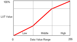
piecewise linear contrast stretch for imagery
Experimental
2015-03-25T13:06:55.564527+00:00
(12)
This plugin creates maps for emergency response purposes. It utilizes the value added products prepared from the satellite images acquired …
2017-05-08T07:31:12.438577+00:00
(6)
This plugin will open the DEFRA MAGIC Map service on the area of your map canvas
2025-02-11T07:25:53.783236+00:00
(18)
Add spatial locations to the citations in your Zotero database.
Experimental
2019-03-22T21:33:34.056316+00:00
(6)
Update transparency of vector symbols in batch mode
Experimental
2011-12-14T13:28:29.503813+00:00
(1)
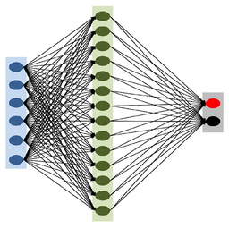
The plugin fragments the remote sensing image, to be used as deep learning training datasets.
Experimental
2020-01-30T06:51:17.890827+00:00
(62)
This tool allows you to extract specific data from IGN's BD TOPO®. The extraction is based on either an extent …
2024-05-16T15:33:34.190606+00:00
(4)
Cadastre. Tool for managing geographic data and metadata to support a legal cadastre. You can make a empty database for …
Experimental
2014-09-15T11:45:17.028436+00:00
(2)
Displays raster’s pixels values to the user, making possible to assign weights for each raster and grades for each class …
Experimental
2023-02-07T20:52:57.365447+00:00
(29)
Plugin developed for the FP7 RASOR Project (http://www.rasor-project.eu/)
2016-01-17T12:09:07.040909+00:00
(16)
Provides access to approximately 300 vector layers and 30 TB imagery, LiDAR, Topographic maps, and Elevation data for the State …
2016-10-06T16:54:19.562185+00:00
(39)
Creates a field layout for a typical row-column breeder's trial
2022-04-08T12:49:04.076193+00:00
(10)
GeoStrategieKit is een plugin waarin verschillende analyses van StraTopo toegankelijk zijn gemaakt waaronder het maken van isochronen.
2023-11-14T11:16:58.475247+00:00
(2)
| Name | Author | Latest Version | Created On | Stars (votes) | ||||
|---|---|---|---|---|---|---|---|---|
|
|
Open Google Maps | 5,201 | Harry King | 2025-01-30T09:40:10.843659+00:00 | 2025-01-30T09:40:08.764428+00:00 |
(9)
|
1.1 | — |
|
|
NDVI and EVI Index Calculator | 5,205 | Emir Memic | 2024-09-15T08:58:45.107958+00:00 | 2024-03-27T05:26:06.590823+00:00 |
(2)
|
0.4 | 0.1 |
|
|
Layout Map Cropper | 6,920 | P. van de Geer | 2021-02-27T19:49:50.457971+00:00 | 2021-02-27T19:49:50.247042+00:00 |
(4)
|
0.1 | — |
|
|
raster PLCS | 5,654 | gillian milani | 2015-03-25T13:06:55.564527+00:00 | 2015-03-24T17:36:43.319361+00:00 |
(12)
|
— | 0.12 |
|
|
Emergency Mapper | 6,209 | GIC - AIT | 2017-05-08T07:31:12.438577+00:00 | 2017-05-08T07:31:12.122800+00:00 |
(6)
|
0.0.1 | — |
|
|
MAGIC Map Loader | 5,769 | DeltaV Geospatial | 2025-02-11T07:25:53.783236+00:00 | 2023-01-20T15:45:05.216869+00:00 |
(18)
|
1.2 | — |
|
|
Literature Mapper | 5,740 | Michele Tobias & Alex Mandel | 2019-03-22T21:33:34.056316+00:00 | 2015-10-13T05:35:19.686022+00:00 |
(6)
|
— | 0.3.2 |
|
|
digitizer | 6,118 | LIS- mafaz | 2023-11-09T05:27:26.642712+00:00 | 2023-09-21T14:41:34.275993+00:00 |
(7)
|
1.0.2 | 1.0 |
|
|
Vector Transparency Manager | 6,868 | Sutton | 2011-12-14T13:28:29.503813+00:00 | 2011-12-13T14:23:10.886456+00:00 |
(1)
|
— | 0.4 |
|
|
Produce Training Data For Deep Learning | 5,778 | Pratyush Tripathy | 2020-01-30T06:51:17.890827+00:00 | 2020-01-10T07:14:47.578509+00:00 |
(62)
|
— | 0.4 |
|
|
BD TOPO® Extractor | 5,297 | Jules GRILLOT | 2024-05-16T15:33:34.190606+00:00 | 2023-07-30T20:42:39.326584+00:00 |
(4)
|
1.0.1 | 0.2.0 |
|
|
Impact toolbox | 5,834 | Hamed Eftekhar @ ANYWAYS | 2023-04-07T08:19:22.382469+00:00 | 2021-01-15T16:34:07.988298+00:00 |
(4)
|
0.9.6 | 0.9.3 |
|
|
TopoDelProp | 5,832 | Joaquin Gaspar Mora Navarro | 2014-09-15T11:45:17.028436+00:00 | 2014-01-22T11:08:00.905152+00:00 |
(2)
|
— | 0.6 |
|
|
Weighted Multi-Criteria Analysis - WMCA | 5,560 | Carvalho Neto, R.M. - UFSM and Benedetti, A.C.P. - UFSM | 2023-02-07T20:52:57.365447+00:00 | 2020-05-20T01:49:52.262429+00:00 |
(29)
|
— | 0.4.2 |
|
|
Go to XYZ | 5,807 | Guillaume Hormière | 2020-07-17T13:46:57.044945+00:00 | 2020-04-07T11:30:06.885864+00:00 |
(4)
|
— | 0.3 |
|
|
RASOR Plugin | 5,239 | Joan Sala (Altamira-Information) | 2016-01-17T12:09:07.040909+00:00 | 2015-07-02T14:54:37.547141+00:00 |
(16)
|
3.0 | 2.2 |
|
|
QTribu | 5,403 | Julien Moura (Geotribu), Guilhem Allaman (Geotribu) | 2024-11-19T18:54:00.287193+00:00 | 2022-07-12T22:02:29.609592+00:00 |
(8)
|
1.1.0 | 1.0.0-beta3 |
|
|
Indiana Open Data Plugin | 5,405 | Justin P. Peters | 2016-10-06T16:54:19.562185+00:00 | 2016-10-06T16:54:19.226010+00:00 |
(39)
|
0.1 | — |
|
|
Breeder Map | 5,440 | Jose A. Jimenez-Berni (IAS-CSIC) | 2022-04-08T12:49:04.076193+00:00 | 2018-02-21T14:36:39.369778+00:00 |
(10)
|
0.3.1 | 0.2 |
|
|
GeoStrategieKit | 5,035 | StraTopo | 2023-11-14T11:16:58.475247+00:00 | 2022-03-08T13:20:36.575481+00:00 |
(2)
|
2.0.3 | — |
Items per page:
Deprecated plugins are printed in red.


