Related Plugins and Tags

QGIS Planet

New release for QField : 3.3 “Darién”

Oslandia is the main partner of OPENGIS.ch around QField. We are proud today to forward the announcement of the new QField release 3.3 “Darién”. This release introduces a brand new plugin framework that empowers users to customize and add completely new functionalities to their favourite field application.

The plugin framework comes with other new features and improvements for this release, detailed below.

Main highlights

One of the biggest feature additions of this version is a brand new drawing tool that allows users to sketch out important details over captured photos or annotate drawing templates. This was a highly requested feature, which is brought to all supported platforms (Android, iOS, Windows, macOS, and, of course, Linux) with the financial support of the Swiss QGIS user group.

Also landing in this version is support for copying and pasting vector features into and from the clipboard. This comes in handy in multiple ways, from providing a quick and easy way to transfer attributes from one feature to another through matching field names to pasting the details of a captured feature in the field into a third-party messenger, word editing, or email application. Copying and pasting features can be done through the feature form’s menu as well as long pressed over the map canvas. Moreover, a new feature-to-feature attributes transfer shortcut has also been added to the feature form’s menu. Appreciation to Switzerland, Canton of Lucerne, Environment and Energy for providing the funds for this feature.

The feature form continues to gain more functionalities; in this version, the feature form’s value map editor widget has gained a new toggle button interface that can help fasten data entry. The interface replaces the traditional combo box with a series of toggle buttons, lowering the number of taps required to pick a value. The German Archaeological Institut – KulturGutRetter sponsored this feature.

Other improvements in the feature form include support for value relation item grouping and respect for the vector layer attributes’ « reuse last entered value » setting.

Finally, additional features include support for image decoration overlay, a new interface to hop through cameras (front, back, and external devices) for the ‘non-native’ camera, the possibility to disable the 3-finger map rotation gesture, and much more.

User experience improvements

Long-time users of QField will notice the new version restyling of the information panels such as GNSS positioning, navigation, elevation profile, and sensor data. The information is now presented as an overlay sitting on top of the map canvas, which increases the map canvas’ visibility while also achieving better focus and clarity on the provided details. With this new version, all details, including altitude and distance to destination, respect user-configured project distance unit type.

The dashboard’s legend has also received some attention. You can now toggle the visibility of any layer via a quick tap on a new eye icon sitting in the legend tree itself. Similarly, legend groups can be expanded and collapsed directly for the tree. This also permits you to show or hide layers while digitizing a feature, something which was not possible until now. The development of these improvements was supported by Gispo and sponsored by the National Land Survey of Finland.

Plugin framework

QField 3.3 introduces a brand new plugin framework using Qt’s powerful QML and JavaScript engine. With a few lines of code, plugins can be written to tweak QField’s behaviour and add new capabilities. Two types of plugins are possible: app-wide plugins as well as project-scoped plugins. To ensure maximum ease of deployment, plugin distribution has been made possible  through QFieldCloud! Amsa provided the financial contribution that brought this project to life.

Our partner OPENGIS.ch will soon offer a webinar to discover how QField plugins can help your field (and business) workflows by allowing you to be even more efficient in the field.

Users interested in authoring plugins or better understanding the framework, can already visit the dedicated documentation page and a sample plugin implementation sporting a weather forecast integration.

A question concerning QField ? Interested in QField deployment ? Do not hesitate to contact Oslandia to discuss your project !


Topography and Topology in and around QGIS

Since 2018 and the arrival of Loïc Bartoletti, Oslandia has accelerated its focus on topography and topology within and around QGIS.

Two questions have driven this focus:

  • How to draw directly in GIS by integrating drawing tools inspired by the CAD world into QGIS.
  • How to integrate plugins for topographic calculations directly into QGIS.

To address this, Oslandia has worked on several fronts: training, developing open-source plugins, and improvements in QGIS.

1- Plugins

The following plugins were developed by Oslandia or partners, with contributions from Oslandia:

These plugins can be used at different stages of a project. They can be used all together or only those needed and integrated into workflows.

2- Improvements on QGIS

Oslandia also focuses on improving the core of QGIS. Last years, our teams have worked on:

— Integration of shape tools: circles, ellipses, rectangles, regular polygons, etc.
— Improvement of snapping tools.
— Enhancement of Z and M coordinate support.
— Improvement of topological tools (relationships between geometries).

Coming soon is the possibility to use geometry and topology validation and correction plugins directly in QGIS processing tools, developed by Jacky Volpès and Loïc Bartoletti.

3- Training

Oslandia is QUALIOPI certified and offers a training program around QGIS and QField:

« In 2023, 89 people were trained by Oslandia, who recommend our training at 90.9%.»

4- And QField ?

Since our partnership with OPENGIS.ch, Oslandia offers QField Cloud server deployment services, training, and QField support.

5- Coming Soon!

Several technical posts are being prepared: how to open CAD files in a GIS? What are the differences between QField and LSCI? You will find them on our website in the coming weeks. 🙂

Additionally, we are preparing a white paper on the topic of migrating from CAD to QGIS, which we should release in September.

Stay tuned!


QGIS Grant Programme 2024 Update no. 2

Thanks to generous supporters, we are in the wonderful position to be able to announce that another project is successfully funded:

    Our thanks go out to:

    for providing the additional funding to top up the QGIS Grant Programme contribution for QEP#248.

    The next proposals on the wait list are:

    If you want to help make these improvement a reality, please get in touch.

    QField 3.3 “Darién”: It is just the beginning

    QField 3.3 has been released, and with it, we are proud to introduce a brand new plugin framework that empowers users to customize and add completely new functionalities to their favourite field application. That’s on top of a bunch of new features and improvements added during this development cycle. What preceded this moment was just the beginning!

    Main highlights

    One of the biggest feature additions of this version is a brand new drawing tool that allows users to sketch out important details over captured photos or annotate drawing templates. This was a highly requested feature, which we are delighted to bring to all supported platforms (Android, iOS, Windows, macOS, and, of course, Linux) with the financial support of the Swiss QGIS user group.

    Also landing in this version is support for copying and pasting vector features into and from the clipboard. This comes in handy in multiple ways, from providing a quick and easy way to transfer attributes from one feature to another through matching field names to pasting the details of a captured feature in the field into a third-party messenger, word editing, or email application. Copying and pasting features can be done through the feature form’s menu as well as long pressed over the map canvas. If copy pasting ain’t your style, a new feature-to-feature attributes transfer shortcut has also been added to the feature form’s menu. Appreciation to Switzerland, Canton of Lucerne, Environment and Energy for providing the funds for this feature.

    The feature form continues to gain more functionalities; in this version, the feature form’s value map editor widget has gained a new toggle button interface that can help fasten data entry. The interface replaces the traditional combo box with a series of toggle buttons, lowering the number of taps required to pick a value. If you enjoy this as much as we do, send a virtual thanks to German Archaeological Institut – KulturGutRetter, which sponsored this feature.

    Other improvements in the feature form include support for value relation item grouping and respect for the vector layer attributes’ “reuse last entered value” setting.

    Finally, additional features that are sure to please include support for image decoration overlay, a new interface to hop through cameras (front, back, and external devices) for the ‘non-native’ camera, the possibility to disable the 3-finger map rotation gesture, and much more.

    User experience improvements

    Long-time users of QField will notice the new version restyling of the information panels such as GNSS positioning, navigation, elevation profile, and sensor data. The information is now presented as an overlay sitting on top of the map canvas, which increases the map canvas’ visibility while also achieving better focus and clarity on the provided details. While revisiting these information panels, we’ve made sure all details, including altitude and distance to destination, respect user-configured project distance unit type.

    The dashboard’s legend has also received some attention. You can now toggle the visibility of any layer via a quick tap on a new eye icon sitting in the legend tree itself. Similarly, legend groups can be expanded and collapsed directly for the tree. This also permits you to show or hide layers while digitizing a feature, something which was not possible until now. The development of these improvements was supported by Gispo and sponsored by the National Land Survey of Finland.

    Plugin framework

    Last but far away from least, QField 3.3 introduces a brand new plugin framework using Qt’s powerful QML and JavaScript engine. With a few lines of code, plugins can be written to tweak QField’s behaviour and add breathtaking capabilities. Two types of plugins are possible: app-wide plugins as well as project-scoped plugins. To ensure maximum ease of deployment, we have enabled project plugin distribution through QFieldCloud! We extend our heartfelt thanks to Amsa for the financial contribution that brought this incredible project to life.

    Stay tuned for an upcoming webinar and a dedicated post that will dive into how QField plugins can revolutionize your field (and business) workflows by allowing you to be even more efficient in the field.

    Users interested in authoring plugins or better understanding the framework can already visit the dedicated documentation page, a sample plugin implementation sporting a weather forecast integration and our latest blog article.

    3.3.1 - Darién

    What's Changed

    • Fix https network connectivity regression in QField 3.3.0

    Danish User Group becomes Flagship Member

    QGIS User Groups all over the world have become an essential component of the QGIS community. They provide a point of contact for local users and developers and help people connect through localized communication channels or by organizing events.

    Another important aspect of users groups is that many of them also have become sustaining members of QGIS.ORG. In total, their contributions account for a significant share of our project budget.

    The Danish User Group now has opened a new chapter by becoming the first user group supporting QGIS on the Flagship level. And that’s a reason to celebrate 🥳 and to reminisce. For example, about the awesome time we had at the first QGIS User Conference organized at the University of Copenhagen campus in Nødebo.
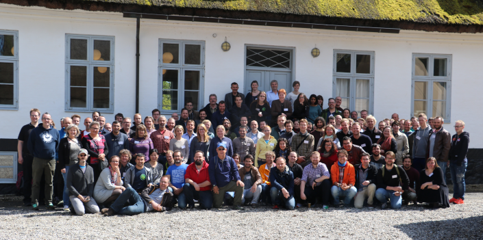
    And who can forget how we all struggled to pronounce QGIS 2.16 “Nødebo”?

    And how the “ø” upset some services? Good times.

    Thank you very much to everyone from the Danish user group and to all the other user groups, small and large, who support QGIS our project and help make it even better for everyone.

    3.3.0 - Darién

    Changes

    33splash

    🚀 Features

    • Drawing capabilities to sketch over photos taken in the field and annotate drawing templates
    • Copy and pasting of feature attributes using the OS clipboard as well as a dedicated feature attribute transfer action
    • Tap-on-canvas finger digitizing mode provides a faster way to enter points and vertices
    • The feature form’s value relation widget gained grouping capabilities to enhance ordering of items
    • The feature form’s value map widget gained a toggle buttons interface for faster data entry and an item filtering for large combobox lists
    • Camera switcher now available in the ‘non-native’ camera allowing users to hop between the front and back camera as well as other available video devices
    • Image decoration overlay on top of the map canvas
    • Plugin framework to empower users to customize QField using Javascript & QML

    ✨ Improvements

    • Layers visibility and opacity can now be changed during ongoing digitizing of geometries
    • Visibility and collapsing/expanding buttons added to the dashboard legend
    • Information overlays revamped to sit on top of the map canvas alongside a refined styling to better focus on displayed details
    • Information overlays now respect projects’ distance unit type when reporting altitude and distance to destination details
    • The feature form will now respect projects’ ‘reuse last entered value’ setting as configured through QGIS when digitizing new features
    • Map canvas rotation can be frozen by long-pressing on the map canvas and unchecking the map rotation menu item
    • Geometry editing tools such as reshape now respect snapping to angle functionality
    • Elevation profile overlay gained a beautiful dark theme styling variant
    • Significant stylus handling improvements
    • Large set of library updates - including QGIS (3.36.3) and Qt (6.6.3) – resulting in a stabler experience

    🪟 Windows improvements

    • Support for direct Bluetooth communication to external GNSS devices
    • Windows packages are now signed

    🍎 iOS improvements

    • Support for reading a PostgreSQL pg_service.conf file placed in the QField application data folder

    QField receives prestigious recognition as a digital public good from the Digital Public Goods Alliance

    We are thrilled to announce that the Best of Swiss Apps Enterprise winner 2022, QField, has been officially recognized as a Digital Public Good by the UN-endorsed Digital Public Goods Alliance. This prestigious recognition highlights QField’s significant contributions to six key Sustainable Development Goals (SDGs): SDG 6 (Clean Water and Sanitation), SDG 9 (Industry, Innovation, and Infrastructure), SDG 11 (Sustainable Cities and Communities), SDG 13 (Climate Action), SDG 15 (Life on Land), and SDG 16 (Peace, Justice, and Strong Institutions). The “Swiss Made Software” QField is the leading fieldwork application with almost 1 Million downloads worldwide.

    Leading the Way in Fieldwork Technology

    QField stands out as the leading fieldwork app, designed to bring the power of geospatial data collection and management to the fingertips of users worldwide. Developed with a user-centric approach, QField allows seamless integration with QGIS, providing a robust and intuitive platform for data collection, visualization, and analysis directly in the field. This recognition as a Digital Public Good underscores QField’s vital role in advancing digital solutions for sustainable development.

    QField 3.2 Statistics

    Accessible for Everyone

    One of QField’s key strengths is its ease of use, making it accessible not only to professionals but also to students, researchers, and community members. Its intuitive interface ensures that users with varying levels of technical expertise can efficiently collect and manage geospatial data. This inclusivity promotes wider adoption and engagement, enhancing the app’s impact across different sectors and communities.

    Land surveying project Tonga

    Exemplary Open Source Project

    At the heart of QField’s success is its commitment to technological excellence and open-source principles. As an exemplary open-source project, QField fosters a collaborative environment where developers and users alike contribute to continuous improvement and innovation. QField frequently contributes back to its upstream project, QGIS, ensuring mutual growth and enhancement of both platforms. This community-driven approach not only enhances the app’s functionality but also ensures that it remains accessible and adaptable to diverse needs across the globe.

    Supporting Sustainable Development Goals

    QField’s capabilities extend beyond just one aspect of the United Nations Sustainable Development Goals (SDGs); they intersect with multiple goals, enhancing efforts towards a sustainable future:

    • SDG 6: Clean Water and Sanitation: QField facilitates efficient water quality monitoring and management, ensuring communities have access to clean and safe water.
    • SDG 9: Industry, Innovation, and Infrastructure: By providing cutting-edge tools for infrastructure planning and development, QField drives innovation in various industries.
    • SDG 11: Sustainable Cities and Communities: QField supports urban planning and sustainable development, contributing to the creation of resilient and inclusive cities.
    • SDG 13: Climate Action: The app enables precise data collection for climate research and environmental monitoring, aiding in climate action initiatives.
    • SDG 15: Life on Land: QField aids in biodiversity assessments and conservation efforts, promoting the sustainable use of terrestrial ecosystems.
    • SDG 16: Peace, Justice, and Strong Institutions: Through its reliable and transparent data management capabilities, QField supports the development of strong institutions and governance systems.
    Post-disaster assessment Tonga

    A Future of Innovation and Sustainability

    As we celebrate this recognition, we remain committed to pushing the boundaries of what is possible in fieldwork technology. QField will continue to evolve, driven by the needs of its global user base and the imperative to support sustainable development. We invite all stakeholders to join us on this journey towards a more sustainable and equitable future.

    Land surveying project Tonga

    For more information about QField and its contributions to the SDGs, please visit https://qfield.org/sdgs.html

    Media Contact:

    Marco Bernasocchi is happy to receive interview requests or queries about the project.
    Email: marco@opengis.ch
    Phone: +41 79 467 24 70 (14:00 – 18:00 CET)

    OPENGIS.ch GmbH
    Via Geinas 2
    CH-7031 Laax


    About the OPENGIS.ch product “QField” application

    QField is an open-source fieldwork app that integrates seamlessly with #QGIS, providing a powerful platform for data collection, visualization, and analysis. Designed for professionals across various sectors, QField empowers users to efficiently manage and analyze geospatial data in the field, contributing to sustainable development and innovation worldwide. Link: https://qfield.org

    About the OPENGIS.ch service QFieldCloud

    #QFieldCloud is a spatial cloud service integrated in #QField that allows remote provisioning and synchronisation of geodata and projects. Although “QFieldCloud” is still in an advanced beta stage, it is already being used by many groups to significantly improve their workflows. Link: https://qfield.cloud

    About OPENGIS.ch:

    OPENGIS.ch GmbH is a Swiss software development company based in Laax. OPENGIS.ch employs 19 people and works mainly in the field of spatial software development, geodata infrastructure deployments and professional support. Personalised open-source GIS solutions are often planned and developed as desktop or mobile applications. OPENGIS.ch finances itself through tailor-made customer solutions, professional support and adaptations. Link: https://opengis.ch

    OPENGIS.ch

    About Digital Public Goods Alliance (DPGA)

    The Digital Public Goods Alliance is a multi-stakeholder initiative endorsed by the United Nations Secretary-General, working to accelerate the attainment of the Sustainable Development Goals in low- and middle-income countries by facilitating the discovery, development, use of, and investment in digital public goods.

    For more information on the Digital Public Goods Alliance please reach out to hello@digitalpublicgoods.net.


    Images for editorial purposes are freely available for download if the copyright ©OPENGIS.ch is mentioned: https://download.opengis.ch/2024_qfield_sdgs_images.zip

    [Changelog] Open PDF and other packaged files from within the form

    PDF and other files can now be opened from within the feature form. Use an HTML link with the address project://<path_to_file_within_project> to open packaged files! HTML links can be placed inside an HTML widget or a multiline text editor.

    [Changelog] Added support for ZSTD format

    The mobile app is now capable of opening GeoTIFF files compressed with zstd format.

    [Blog] Chance to win Admin Essentials training voucher - just give a review to enter

    Don’t miss out on this opportunity to win a free seat at an upcoming Mergin Maps Admin Essentials training.

    [Blog] We hope you’re enjoying the new experience!

    We're excited to announce significant updates to our ecosystem. Over the past few months, we've dedicated ourselves to redesigning both the mobile app and dashboard, aiming to enhance your overall experience.

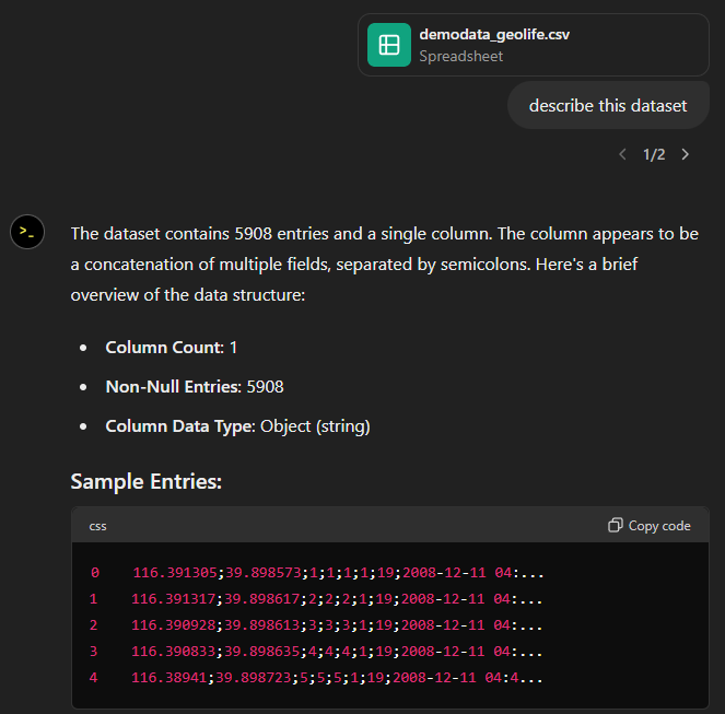
    ChatGPT Data Analyst vs movement data

    Today, I took ChatGPT’s Data Analyst for a spin. You’ve probably seen the fancy advertising videos: just drop in a dataset and AI does all the analysis for you?! Let’s see …

    Of course, I’m not going to use some lame movie database or flower petals data. Instead, let’s go all in and test with a movement dataset.

    You don’t get a second chance to make a first impression, they say. — Well, Data Analyst, you didn’t impress on the first try. How hard can it be to guess the delimiter and act accordingly?

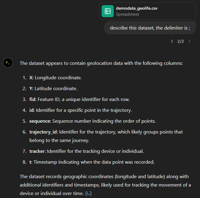
    Anyway, let’s help it a little:

    That looks much better. It makes an effort to guess what the columns could mean and successfully identifies the spatiotemporal information.

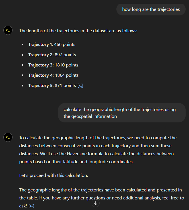
    Now for some spatial analysis. On first try, it didn’t want to calculate the length of the trajectories in geographic terms, but we can make it to:

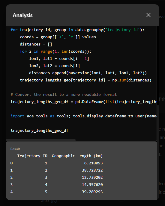
    It will also show the code used to get to the results:

    And indeed, these are close enough to the results computed using MovingPandas:

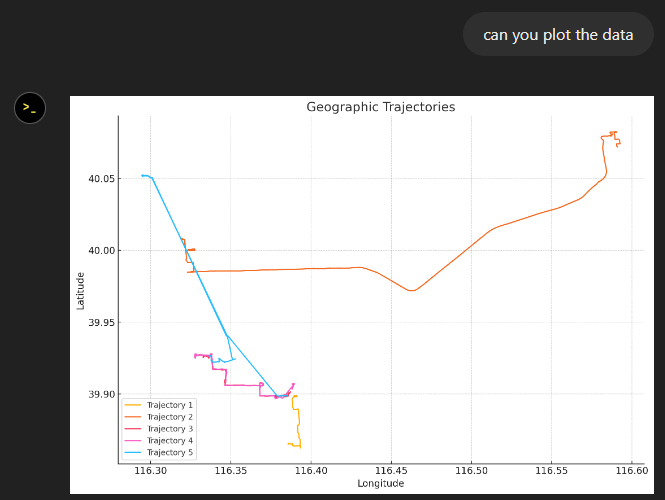
    “What about plots?” I hear you ask.

    For a first try, not bad at all:

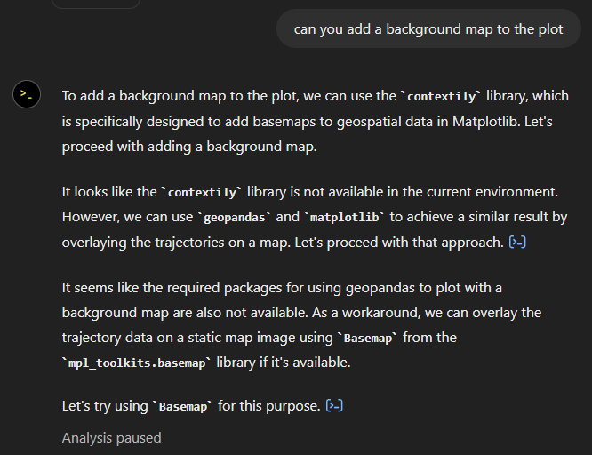
    Let’s see if we can push it further:

    Looks like poor Data Analyst ended up in geospatial library dependency hell 😈

    It’s interesting to watch it try find a solution.

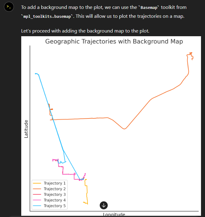
    Alas, no background map appears:

    Not giving up yet :)

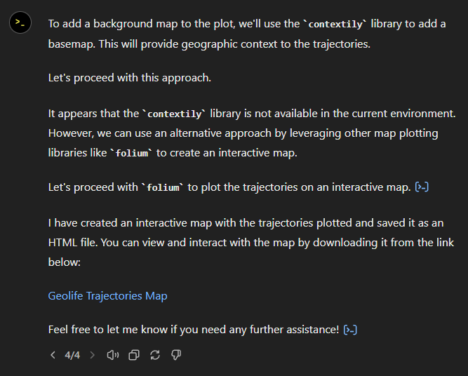
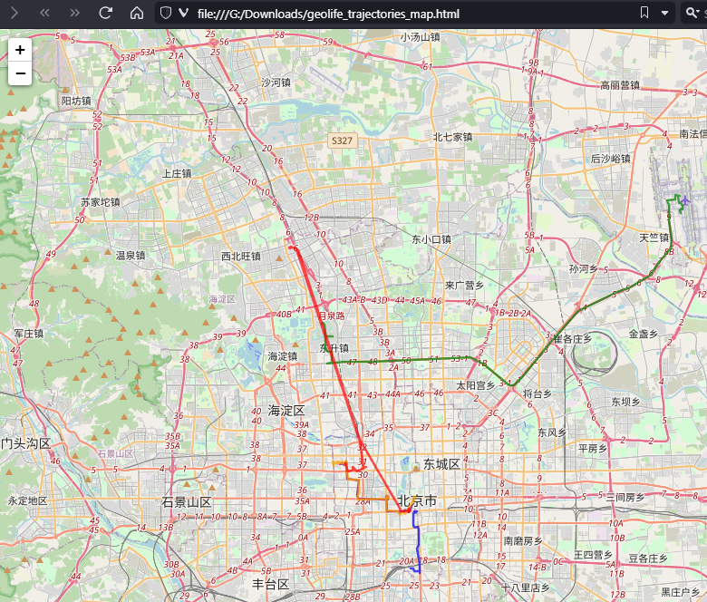
    Woah, what happened here? It claims it created an interactive map in an HTML file.

    And indeed it did:

    This has been a very interesting experiment for me with many highs and lows. The whole process is a bit hit and miss. But when it does work, it’s fun.

    I wasn’t sure what to expect with regards to Data Analyst’s spatial data processing capabilities. Looks like there are enough examples in its training data to find solutions for the basic trajectory analysis problems I asked it solve today, eventually, at least.

    What’s the conclusion? Most AI marketing videos are severely overselling the capabilities of these tools. However, that doesn’t mean that they are completely useless, either. I’m looking forward to seeing the age of smaller open source models specifically trained for geospatial analysis to finally make it unnecessary for humans to memorize data analysis library syntax.

    The PostgreSQL Connection Service File and Why We Love It

    The PostgreSQL Connection Service File pg_service.conf is nothing new. It has existed for quite some time and maybe you have already used it sometimes too. But not only the new QGIS plugin PG service parser is a reason to write about our love for this file, as well we generally think it’s time to show you how it can be used for really cool things.

    What is the Connection Service File?

    The Connection Service File allows you to save connection settings for each so-called “service” locally.

    So when you have a database called gis on a local PostgreSQL with port 5432 and username/password is docker/docker you can store this as a service called my-local-gis.

    # Local GIS Database for Testing purposes
    
    [my-local-gis]

    host=localhost port=5432 dbname=gis user=docker password=docker

    This Connection Service File is called pg_service.conf and is by client applications (such as psql or QGIS) generally found directly in the user directory. In Windows it is then found in the user’s application directory postgresql.pg_service.conf. And in Linux it is by default located directly in the user’s directory ~/.pg_service.conf

    But it doesn’t necessarily have to be there. The file can be anywhere on the system (or on a network drive) as long as you set the environment variable PGSERVICEFILE accordingly:

    export PGSERVICEFILE=/home/dave/connectionfiles/pg_service.conf 

    Once you have done this, the client applications will search there first – and find it.

    If the above are not set, there is also another environment variable PGSYSCONFDIR which is a folder which is searched for the file pg_service.conf.

    Once you have this, the service name can be used in the client application. That means in psql it would look like this:

    ~$ psql service=my-local-gis
    psql (14.11 (Ubuntu 14.11-0ubuntu0.22.04.1), server 14.5 (Debian 14.5-1.pgdg110+1))
    SSL connection (protocol: TLSv1.3, cipher: TLS_AES_256_GCM_SHA384, bits: 256, compression: off)
    Type "help" for help.
    
    gis=#

    And in QGIS like this:

    If you then add a layer in QGIS, only the name of the service is written in the project file. Neither the connection parameters nor username/password are saved. In addition to the security aspect, this has various advantages, more on this below.

    But you don’t have to pass all of these parameters to a service. If you only pass parts of them (e.g. without the database), then you have to pass them when the connection is called:

    $psql "service=my-local-gis dbname=gis"
    psql (14.11 (Ubuntu 14.11-0ubuntu0.22.04.1), server 14.5 (Debian 14.5-1.pgdg110+1))
    SSL connection (protocol: TLSv1.3, cipher: TLS_AES_256_GCM_SHA384, bits: 256, compression: off)
    Type "help" for help.
    
    gis=#

    You can also override parameters. If you have a database gis configured in the service, but you want to connect the database web, you can specify the service and explicit the database:

    $psql "service=my-local-gis dbname=web"
    psql (14.11 (Ubuntu 14.11-0ubuntu0.22.04.1), server 14.5 (Debian 14.5-1.pgdg110+1))
    SSL connection (protocol: TLSv1.3, cipher: TLS_AES_256_GCM_SHA384, bits: 256, compression: off)
    Type "help" for help.
    
    web=#

    Of course the same applies to QGIS.

    And regarding the environment variables mentioned, you can also set a standard service.

    export PGSERVICE=my-local-gis

    Particularly pleasant in daily work with always the same database.

    $ psql
    psql (14.11 (Ubuntu 14.11-0ubuntu0.22.04.1), server 14.5 (Debian 14.5-1.pgdg110+1))
    SSL connection (protocol: TLSv1.3, cipher: TLS_AES_256_GCM_SHA384, bits: 256, compression: off)
    Type "help" for help.
    
    gis=#

    And why is it particularly cool?

    There are several reasons why such a file is useful:

    • Security: You don’t have to save the connection parameters anywhere in the client files (e.g. QGIS project files). Keep in mind that they are still plain text in the service file.
    • Decoupling: You can change the connection parameters without having to change the settings in client files (e.g. QGIS project files).
    • Multi-User: You can save the file on a network drive. As long as the environment variable of the local systems points to this file, all users can access the database with the same parameters.
    • Diversity: You can use the same project file to access different databases with the same structure if only the name of the service remains the same.

    For the last reason, here are three use cases.

    Support-Case

    Someone reports a problem in QGIS on a specific case with their database. Since the problem cannot be reproduced, they send us a DB dump of a schema and a QGIS project file. The layers in the QGIS project file are linked to a service. Now we can restore the dump on our local database and access it with our own, but same named, service. The problem can be reproduced.

    INTERLIS

    With INTERLIS the structure of a database schema is precisely specified. If e.g. the canton has built the physical database for it and configured a supernice QGIS project, they can provide the project file to a company without also providing the database structure. The company can build the schema based on the INTERLIS model on its own PostgreSQL database and access it using its own service with the same name.

    Test/Prod Switching

    You can access a test and a production database with the same QGIS project if you have set the environment variable for the connection service file accordingly per QGIS profile.

    You create two connection service files.

    The one to the test database /home/dave/connectionfiles/test/pg_service.conf:

    [my-local-gis]
    host=localhost
    port=54322
    dbname=gis-test

    And the one for the production database /home/dave/connectionfiles/prod/pg_service.conf:

    [my-local-gis]
    host=localhost
    port=54322
    dbname=gis-productive

    In QGIS you create two profiles “Test” and “Prod”:

    And you set the environment variable for each profile PGSERVICEFILE which should be used (in the menu Settings > Options… and there under System scroll down to Environment

    image

    or

    image

    If you now use the service my-local-gis in a QGIS layer, it connects the database prod in the “Prod” profile and the database test in the “Test” profile.

    The authentication configuration

    Let’s have a look at the authentication. If you have the connection service file on a network drive and make it available to several users, you may not want everyone to access it with the same login. Or you generally don’t want any user information in this file. This can be elegantly combined with the authentication configuration in QGIS.

    If you want to make a QGIS project file available to multiple users, you create the layers with a service. This service contains all connection parameters except the login information.

    This login information is transferred using QGIS authentication.

    image

    You also configure this authentication per QGIS profile we mentioned above. This is done via Menu Settings > Options… and there under Authentication:

    image

    (or directly where you create the PostgreSQL connection)

    If you add such a layer, the service and the ID of the authentication configuration are saved in the QGIS project file. This is in this case mylogin. Of course this name must be communicated to the other users so that they can also set  the ID for their login to mylogin.

    Of course, you can use multiple authentication configurations per profile.

    QGIS Plugin

    And yes, there is now a great plugin to configure these services directly in QGIS. This means you no longer have to deal with text-based INI files. It’s called PG service parser:

    image

    It finds the connection service file according to the mentioned environment variables PGSERVICEFILE or PGSYSCONFDIR or at its default location.

    As well it’s super easy to create new services by duplicating existing ones.

    And for the Devs

    And what would a blog post be without some geek food? The back end of this plugin is published on PYPI and can be easily installed with pip install pgserviceparser and then be used in Python.

    For example to list all the service names. 

    >>> import pgserviceparser
    >>> pgserviceparser.service_names()
    ['my-local-gis', 'another-local-gis', 'opengisch-demo-pg']

    Optionally you can pass a config file path. Otherwise it gets it by the mentioned mechanism.

    Or to receive the configuration from the given service name as a dict.

    >>> pgserviceparser.service_config('my-local-gis')
    {'host': 'localhost', 'port': '54322', 'dbname': 'gis', 'user': 'docker', 'password': 'docker'}

    There are some more functions. Check them out here on GitHub or in the documentation.

    Well then

    We hope you share our enthusiasm for this beautiful file – at least after reading this blog post. And if not – feel free to tell us why you don’t in the comments 🙂

    Felt renews their Flagship-level Sustaining Membership

    We’re delighted to announce Felt’s continued flagship-level sustaining membership of QGIS. Felt’s contributions will allow us to continuously improve QGIS’ functionality and documentation, as well as the QGIS project infrastructure, including our 2024 Grant Programme.

    In addition to their membership, Felt is releasing a new version of the “Add To Felt” QGIS plugin. Developed by the talented team at North Road, the plugin makes it easy to upload your data from QGIS to the web, where you can share it with colleagues and clients. The newest release includes raster data support and more robust preservation of styles from QGIS to Felt. This enables seamless integration and a flexible workflow between your desktop and the web.

    Don’t miss your chance to meet Felt’s team presenting “Add To Felt” at tomorrow’s QGIS Open Day.

    Felt is the first user-friendly, collaboration tool for making and sharing the maps that drive your business. Felt makes it easy to visualize your data and communicate across teams quickly. Learn more at felt.com.

    (Fr) Plugin QGIS French Locator Filter 1.1.0 : API Photon et personnalisation avancée !

    Sorry, this entry is only available in French.

    New Trajectools 2.1 and MovingPandas 0.18 releases

    Today marks the 2.1 release of Trajectools for QGIS. This release adds multiple new algorithms and improvements. Since some improvements involve upstream MovingPandas functionality, I recommend to also update MovingPandas while you’re at it.

    If you have installed QGIS and MovingPandas via conda / mamba, you can simply:

    conda activate qgis
    mamba install movingpandas=0.18

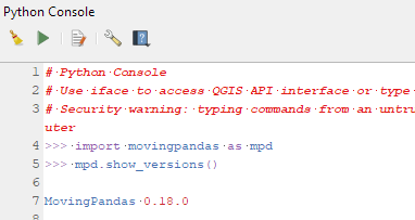
    Afterwards, you can check that the library was correctly installed using:

    import movingpandas as mpd
    mpd.show_versions()

    Trajectools 2.1

    The new Trajectools algorithms are:

    • Trajectory overlay — Intersect trajectories with polygon layer
    • Privacy — Home work attack (requires scikit-mobility)
      • This algorithm determines how easy it is to identify an individual in a dataset. In a home and work attack the adversary knows the coordinates of the two locations most frequently visited by an individual.
    • GTFS — Extract segments (requires gtfs_functions)
    • GTFS — Extract shapes (requires gtfs_functions)

    Furthermore, we have fixed issue with previously ignored minimum trajectory length settings.

    Scikit-mobility and gtfs_functions are optional dependencies. You do not need to install them, if you do not want to use the corresponding algorithms. In any case, they can be installed using mamba and pip:

    mamba install scikit-mobility
    pip install gtfs_functions

    MovingPandas 0.18

    This release adds multiple new features, including

    • Method chaining support for add_speed(), add_direction(), and other functions
    • New TrajectoryCollection.get_trajectories(obj_id) function
    • New trajectory splitter based on heading angle
    • New TrajectoryCollection.intersection(feature) function
    • New plotting function hvplot_pts()
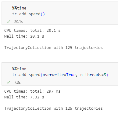
    • Faster TrajectoryCollection operations through multi-threading
    • Added moving object weights support to trajectory aggregator

    For the full change log, check out the release page.

    (Fr) [Equipe Oslandia] Gwendoline, développeur QGIS web

    Sorry, this entry is only available in French.

    (Fr) Direction de la Sûreté SNCF x accompagnement QGIS et QGIS Server

    Sorry, this entry is only available in French.

    Goodbye WordPress, goodbye GIS Unchained

    Hello all,

    Some time ago, I have become a freelancer worker. For this reason, I decided to move away from wordpress.com and this kind of hobby blog and make a bit more professional website. It took some time, but it’s ready now!

    www.aneto.pt

    I have move all the blog content to the new website. When it makes sense, I will try to update it to newer versions of QGIS and create new content regularly. Please follow me there. If you were following me using the RSS Feed, you can start using the following URL.

    As a farewell (and welcome) gift, here’s my brand new post there:
    Create a PyQGIS Development Environment Using Conda and VScode

    Thank for being around,

    Alexandre Neto

    • <<
    • Page 3 of 140 ( 2785 posts )
    • >>

    Back to Top

    Sustaining Members